Validating Sargassum forecasts with Sentinel-2 data
- 11 June 2019
- Category: Sargassum
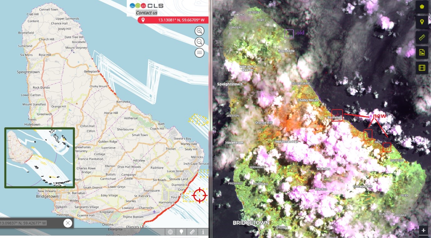
Since April 1st, a group of 40+ users have been testing the Sargassum detection and monitoring service developed by CLS and Novablue Environment within the framework of an ESA Open Call Science for Society project. One of these users, Juerg Lichtenegger, Switzerland, uses ESA EO Open Data from Sentinel-2 and -3 (optical) satellites to evaluate and validate CLS Group’s sargassum drift forecasts and help CLS improve their service. Learn more about the drift model and the results in the article below.
How does the CLS Group sargassum detection and drift model work?
To detect sargassum, the CLS service relies on a unique combination of ocean color sensors (OLCI on Sentinel-3 and MODIS on Aqua) and high resolution optical sensors on Sentinel-2 and Landsat-8. These sensors make it possible to calculate an NFAI (Normalized Floating Algae Index), inherited from references works of Jim Gower (MCI) and Chuan Min Hu (AFAI) but using different wavelengths to obtain the highest possible pixel resolution for each sensor.
Our drift model uses surface current models such as HYCOM and CMEMS (depending on the region) and wind speed data from ECMWF/NCEP. Sargassum mats detected from satellite are advected with MOBIDRIFT model (Lagrangian advection model) using a probabilistic approach to take into account the uncertainties on wind and current forcing fields). This allows us to produce 2-3 day forecasts via the online user interface in 11 user-dedicated zones in the Caribbean and Gulf of Mexico. The resolution of the model currently being used is 10 km. CLS is working to improve the resolution of our model in order to provide fine-meshed forecasts in the near future.
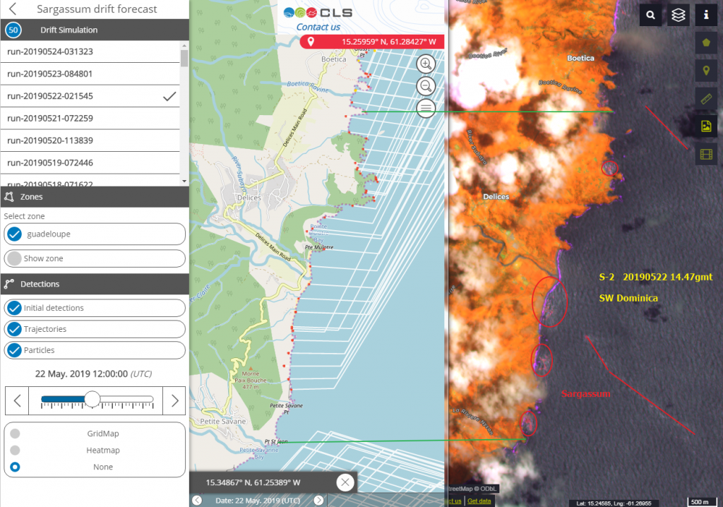
Are the forecasts reliable?
The work of Juerg Lichtenegger helps CLS to validate the drift model with free high-resolution optical imagery (Sentinel-2 and Landsat-8). CLS and Novablue Environment are also working with a number of users in the Caribbean and Gulf of Mexico to obtain photos from local sources to confirm the forecasts.
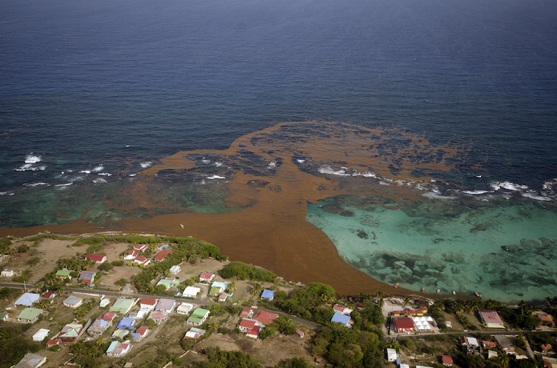
Photo courtesy of Jean-Philippe Maréchal
Free trial of the sargassum detection and forecasting service until June 15th, 2019
If you are interested in trying out this service for free (until June 15th, 2019), please submit a request for access via the following address: sargas-ops@groupcls.com
Learn more
CLS Operational Sargassum service ready for end-users
ESA explains the CLS sargassum monitoring and detection service
About CLS
CLS, a subsidiary of the French Space Agency (CNES), ARDIAN & IFREMER, is a worldwide company and pioneer provider of monitoring and surveillance solutions for the Earth since 1986. Our mission is to deploy innovative satellite-based monitoring solutions to understand and protect our planet, and to manage its resources sustainably.