30 years of earth observation and spatial oceanography
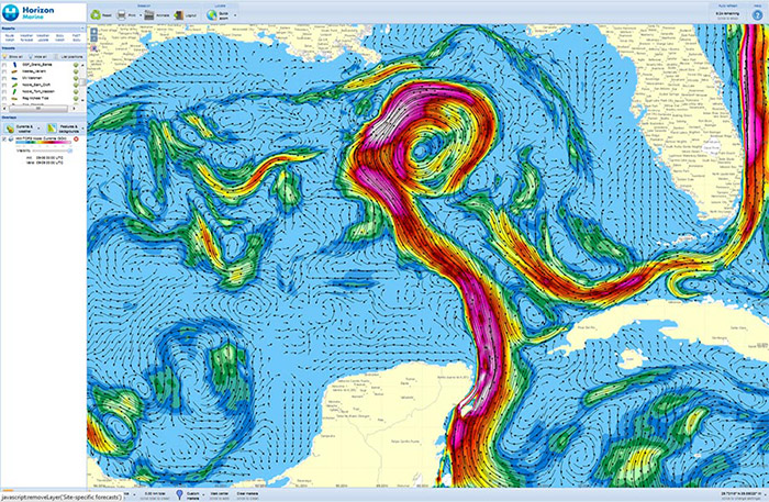
Today, satellites play a key role in operational oceanography. They provide continuous, long-term global observations of the physical and biological state of the ocean variables (wind, waves, sea surface temperature, ocean color, etc) that drive its variability.
CLS teams started to develop Aviso system to archive altimetry data. The same year, the ERS-1 satellite is placed in orbit and took on board an altimeter.
The Topex/Poseidon satellite was launched with the objective of “observing and understanding the ocean circulation”. A joint project between Nasa and Cnes. It carried two radar altimeters and precise orbit determination systems, including the Doris system.
CLS helps to develop the
Mersea integrated project, an European system for operational monitoring and forecasting of the ocean variables and ecosystems, on global and regional scales. This project laid the groundwork for EUROGOOS, European Global Ocean Observing system


The observer program Jason oceans, which embodies the program experimental Topex / Poseidon is approved.
The satellite Spot 4 satellite is launched with a Doris instrument.
CLS sold for the first time oceanographic products : elevation maps, colors of water, etc
CLS helps to develop the
CLS provides to all competitors of the legendary race The Vendée Globe real-time location tag and offers a preview to the Race service ice detection.